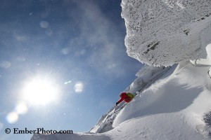
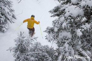
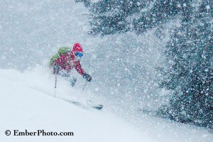
Thanks to nightly snow showers late last week, nearly a foot of fresh snow loaded into many higher elevation nooks and crannies across the Northeast by Saturday morning. And with high pressure prevailing and blue skies overhead this weekend, it was hard to imagine that we were skiing in the rain, sleet (and hail?) just …
Category: Backcountry Update
Feb 03
VIDEO: The Zero Approach Ski Tour
While some nice fresh snow has been piling up at higher elevations this past week (in the 1-5″ range) there’s nothing but a good ol’ fashioned crust coating most lower to middle elevation terrain. Fortunately, this crust is relatively supportive and offers a smooth skiing surface, especially with some fatter skis. Close to home, our …
Jan 30
Photos of the Week: Super Fluff
Thanks to another passing cold front last night and this morning, skiers across the northeast were treated to as much as 6-8″ of super fluff today (Monday 1/30). For many skiers across the region, it was nothing less than a good old fashioned powder day – and a far cry from the dust on crust …
Jan 06
Photo(s) of the Week: Shallow Powder and Alpenglow
Scattered snow showers continue to add precious white snowflakes to our relatively thin snowpack across the Northeast, with up to 4″ of Champlain Powder falling around VT’s Mt. Mansfield on Thursday. While most off-piste lines still need quite a bit of natural-snow base, others are really starting to take shape. The first image here was …
Dec 28
Photo of the Week – Champlain Powder
The powerful storm that treated us last night to wet snow, sleet and POURING rain also produced some of the most intense mountain snowfall we’ve ever witnessed in the northeast. A still unfrozen Lake Champlain, an approaching cold front and a good orographic (upslope) flow of moisture definitely contributed to today’s prolific snowfall. At one …

